Geography at your fingertips - fieldwork in your local area
01 July 2021
 Charlotte Foster, Flatford Mill Field Studies Council
Over the last year, we’ve all got to know our local areas much better. Whether we now feel a closer connection to our neighbourhoods, or can’t wait to broaden our horizons once more, I think that staying local still has a lot to offer… for fieldwork!
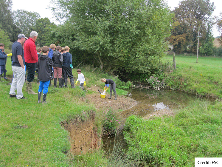
Here are a few options to try out, to build and maintain momentum in students’ geographical learning: incorporating skills, seeing themes and concepts in real life and investing in the enquiry process that underpins the subject’s evolution.
Hopefully, we’ll be back in field studies centres and our field trip locations over the coming months. However, engaging in the route to enquiry and finding those ‘hooks’ to capture students’ interest in the complex geographies around us is still possible in the streets, parks and countryside surrounding our schools and homes. It’s been a difficult year in many respects, but academically, we may feel that the first step for students is to get back that love for our subject. And as geographers, that means being curious about the world around us.
Begin where we’re at: the pandemic
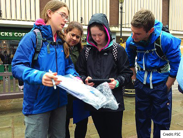 Having shaped so much of our everyday lives for months, students will be interested in the impacts of the pandemic. We can use this ‘hook’ to explore some of the themes in human topics, such as looking at urban trends or economic growth or decline. By doing this in your local town or street, you are doing two things:
- engaging with a place that matters to the students, which they will have confidence in commenting on, and
- following safety principles of staying more local.
Students could even take their photos on the walk home or when out with their family and bring the photos in to work with, to avoid the safety concerns of arranging a trip as a large group.
One technique to help do this is rephotography. For this you need an old photo of an area, perhaps from older Google Street View imagery or pre-pandemic newspaper articles. Your students then re-visit that site and take a new photo from as similar an angle as is safely and practically possible. The next stage is to annotate the two images.
This could be done as if it were evidence of a geographical theme, for example economic decline. In this case students might identify and explain the number of charity shops, the range of service users, and how many shops have shut as a result of lockdowns.
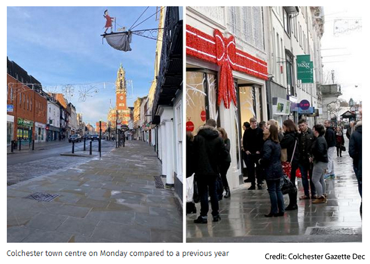 Alternatively, it could be used as a starting point for a local fieldwork enquiry. You can use the two images to prompt possible questions. For example, has the pandemic caused the closure of particular types of shops? Are the types of visitors to the area different post-pandemic? Why?
In this case, you could follow up the interests of the students as a mini-fieldwork enquiry process, highlighting other skills. For example, they could find locating the place on an OS map using grid references, photo orientation, distance of the scene from the town centre or other key points using the map scale, evaluation of the method and so on. You might even encourage students to suggest and explore valid secondary data sources to expand on and evidence findings.
Human geographies through non-human lenses
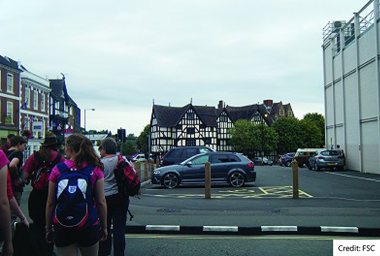 Again, a significant benefit of using local places for fieldwork is that they are likely to intertwine tightly with the students’ geographies. Lots of current topics that will be part of your students’ - geographies link directly to GCSE and A Level topics and concepts. For example, the steps we’ve taken to manage the pandemic link to ideas of mitigation, risk, and inequalities in terms of individuals’ ability to mitigate risk.
How has that worked in your local area? Black Lives Matter and decolonising are narratives that might be close to students’ hearts and lived experience. This links to themes they’ll cover in geography, such as identity and inequalities. What does that look like for them in their communities?
GCSE students may be interested in the change in commuting patterns they’ve seen recently, but what does this mean for the topics they cover in geography like counter-urbanisation or challenges around housing and sustainable transport or economies?
We don’t always need to do a full enquiry to incorporate fieldwork skills. Even just doing part of the route to enquiry can build skills in certain sections, such as presenting data or drawing conclusions. Although the topics we want to study may seem inherently ‘human’ we don’t need to observe or measure them by interacting with other humans. Could we abandon our questionnaires and interviews for now and try something more remote?
Walkability survey
As a suggestion, you could try a Walkability survey to consider accessibility and inequalities, inclusive and exclusive spaces. You can even use the bigger dataset of this world-wide methodological approach to set your local street in context. You can see an example of this at ScienceDirect.com 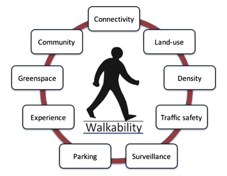
You could try place narratives or non-participant observations to find out how people use the area and their opinions of it, or your students’ own experiences of moving through the places instead of surveying visitors.
Students can always be supported through online questionnaires if they are concerned about the reliability of the remote approaches. You could use wet wipes to ‘test’ for pollution levels on lamp posts or use phone apps to measure sound levels around roads instead of surveying local people on their view of the impacts of suburbanisation or economic trends affecting a town.
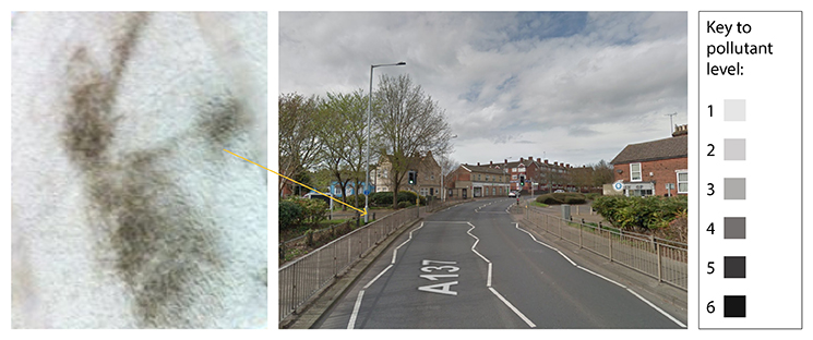 Not only do these suggestions have the time and safety advantages of being possible in the local area, they can be done without interacting directly with members of the public. They also encourage students to ‘think like geographers’ and rely more on their own observations and interpretations, rather than passively taking observations from other users of the area. A great part of the skills toolkit students will need in their geography careers.
Telling stories
If you are familiar with ESRI ArcGIS online or would like to be, you could go down the virtual fieldwork route. ArcGIS online subscriptions are free to all schools and with your subscription you can access ArcGIS StoryMaps.
This app allows you to show maps, images, videos, datasets and more alongside a written narrative – telling the story about a place you’re going to give data for or even sequencing a whole geographical enquiry from background theory to final conclusions and evaluation. You author them, so you can include what you want and have tasks running through the StoryMap. Students can also interact with the maps and data since you embed your own web maps from ArcGIS online (or you can use pre-made maps too like the census data, phew!).
I’ve included some example StoryMaps. Some of these examples may even suit the topics you want to teach.
While this virtual approach is a great alternative to fieldwork in restricted times, StoryMaps are also something you may wish to continue using, even when we return to real life fieldwork experience.
Used as pre-trip resources, StoryMaps can allow students to get to know a location at their own pace before the trip. They can explore relevant secondary data, get ideas for sampling strategies, valid variables to measure and get excited about the geography they’re going to explore as they’re setting up a more personal ‘need to know’ resource.
I have focused mainly on human topics because generally they are more accessible from the location of a school, and we may be more apprehensive about ‘human’ field trips as they occur in busier places. As geography teachers, we are in a privileged position of being able to show students the world, empower them to become agents of change through that understanding, and ultimately be aware and caring world citizens. And they can start right on their own doorsteps.
Stay connected
As always, OCR subject advisors are here to support you and your students. If you have questions you can email geography@ocr.org.uk or send your tweets to @OCR_Geography. You can also sign up for email updates to receive information about resources and support.
About the author
Charlotte is the senior tutor at Flatford Mill and an important geographer for the FSC development team. Charlotte gained a degree in geography at Durham and then furthered her academic career with an MSc in Biogeography and then a PGCE in secondary geography. She went on to teach secondary and 6th form students in schools in Durham and Suffolk for before joining the FSC as a tutor in 2016, quickly progressing to be a senior tutor. For the last six years Charlotte has been sharing her love of geography and biology with the students visiting Flatford Mill.